Xi’an, nestled in the heartland of Northwest China, is an ancient city rich in history and culture, serving as a significant cultural, economic, and educational center in the region.
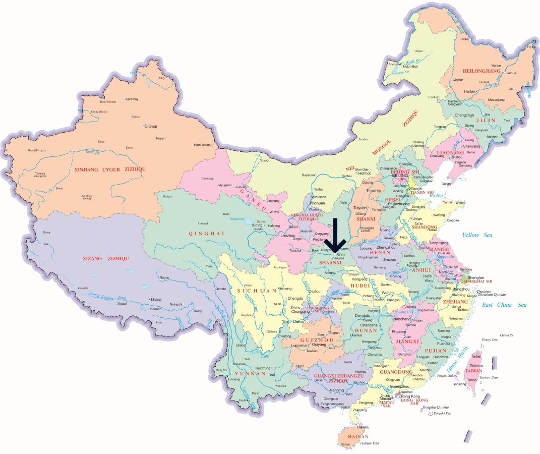
Xi'an’s Location in China
Xi’an is located at the eastern end of the Silk Road, and is the capital of Shaanxi Province. It is surrounded by the Qinling Mountains to the south and the Weihe River to the north, making it a strategic location historically. Nearby notable cities include Baoji to the west, Tongchuan to the north, and Weinan to the east, positioning Xi’an as a pivotal hub in central China.
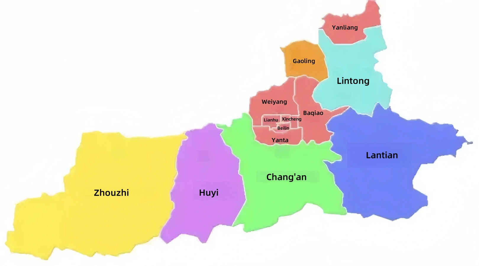
Map of Xi'an’s Administrative Districts
Xi’an is divided into 11 administrative districts and 2 counties. The districts include Xincheng, Beilin, Lianhu, Baqiao, Weiyang, Yanta, Yanliang, Lintong, Chang’an, Gaoling, and Huyi, alongside Lantian and Zhouzhi counties. Each district and county has its own unique contributions to the city’s diverse heritage and modern development, embodying the blend of ancient traditions and contemporary progress that characterizes Xi’an.
Popular City Maps
Access detailed maps of popular cities in China for quick orientation on regions and transportation networks.


 English (US)
 繁體中文
繁體中文  日本語
日本語  한국어
한국어  ไทย
ไทย  Русский