Lhasa, located in the Tibet Autonomous Region of China, is a city rich in history, culture, and spiritual significance. As the capital of Tibet, it is a unique blend of ancient traditions and modern developments.
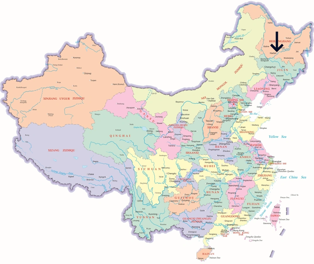
Lhasa’s Location in China
Lhasa is situated in the central part of China’s Tibet Autonomous Region, along the Lhasa River, which is a major tributary of the Yarlung Tsangpo River. The city is surrounded by the Himalayan mountain range to the south and the vast Tibetan Plateau to the north. Lhasa serves as the political, cultural, and spiritual capital of Tibet and is located at an elevation of more than 3,600 meters (11,800 feet) above sea level.
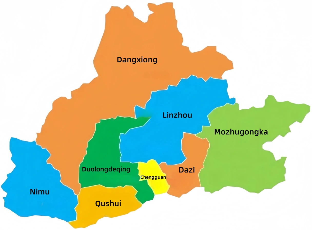
Map of Lhasa’s Administrative Districts
Lhasa is divided into 8 administrative districts, including 3 urban districts and 5 counties. These include Chengguan, Duilongdeqing, and Dazi Districts, as well as Linzhou, Nimu, Dangxiong, Qushui, and Mozhugongka Counties. Each area offers a unique glimpse into Tibetan culture, lifestyle, and natural beauty.
Popular City Maps
Access detailed maps of popular cities in China for quick orientation on regions and transportation networks.
 English (US)
 繁體中文
繁體中文  日本語
日本語  한국어
한국어  ไทย
ไทย  Русский